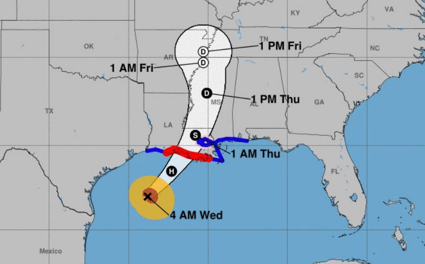
Francine now a Category 1 hurricane
Published 9:48 am Wednesday, September 11, 2024
|
Getting your Trinity Audio player ready...
|
Francine intensified into a Category 1 hurricane overnight with maximum sustained winds of 90 mph.
The storm continues to head northeast at 10 mph.
The National Weather Service’s Lake Charles office said landfall is expected tonight across south central Louisiana as a high-end category 1 or low-end category 2 hurricane.
Trending
The highest storm surge is expected across the Vermillion and Atchafalaya bays. The storm surge warning has been downgraded to a coastal flood advisory across western Cameron.
A tropical storm warning remains in effect for Cameron, Calcasieu, Jeff Davis and Allen parishes. Southwest Louisiana could start experiencing tropical-storm winds around 2 p.m. today.
The potential for winds to range from 58-73 mph exists for areas east of a line from Lake Charles to Bunkie.
The potential for a few tornadoes exists along and east of a line from Cameron to Bunkie.