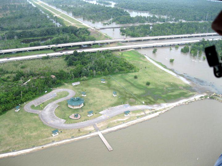
Reasons behind Ike flooding complicated
Published 12:00 am Tuesday, September 16, 2008
By ROBIN SHANNON
Staff Reporter
LAPLACE – Hurricane Ike came ashore last Friday evening along the Texas coast, but the effects of the powerful category 2 storm were felt as far east as St. John Parish – nearly 250 miles away.
While the storm was pounding Galveston and Houston with winds and rain, it was also flooding the roads and neighborhoods of several St. John subdivisions with a surge of water from Lake Pontchartrain and Lake Maurepas, which were still swelled from the aftermath of Hurricane Gustav.
“The lakes have not had sufficient time to drain out,” said Robert Ricks, lead forecaster for the National Weather Service in Slidel. “Whenever a storm is in the Gulf, more water will end up getting pushed into the nearby lakes. It was just unfortunate that these two storms really came back to back.”
This quick storm turnaround caused some of the worst storm surge St. John Parish has experienced since the 1980s, when Hurricane Juan came through the area and stalled for several days.
“It was actually worse than that since many areas that took on water had not been built at the time Juan came through,” said St. John Public Information Officer Buddy Boe. “The water started to creep up Friday night and continued to rise throughout Saturday. It was pretty unexpected.”
Boe said certain streets and neighborhoods that saw no water for Hurricane Gustav were inundated from Ike’s storm surge, which was not predicted to be as high.
“Projections from the National Weather Service indicated we may see 3 to 4 foot storm surge, when we actually had 5 to 7 foot surge,” Boe said.
Ricks said that in addition to the higher lake levels, the size of Hurricane Ike was another key factor in the level of surge and the ferocity at which the water came up. Unlike Hurricane Gustav, which was a small, compact storm system, Ike was a massive tropical disturbance that took up almost the entire Gulf of Mexico. Ricks said hurricanes of that size usually carry with it circulation levels than span several hundred miles.
“Even though parts of Louisiana were only getting the outer bands of circulation, it was still the worst side of the storm,” said Ricks. “Strong winds were blowing in from the southeast and just continuously pushing water into the lake and into neighborhoods.”
So when will all this water get out of here, and how long will it take? Ricks said that since the lakes are part of the drainage system in this area, the water wouldn’t subside until the lake subsides and that won’t occur until the Gulf subsides.
“We were watching a frontal system coming down from the north, but it didn’t get far enough south to have any affect on the water,” said Ricks. “But the winds are going to change in the next several days. Once it starts blowing from the north and west, it will begin to steer water out of the lake and out of neighborhoods.”
Boe said the weekend’s flooding is just another reminder of the importance of a hurricane levee in St. John Parish.
“If we even had just category 2 protection, we would have been ok,” said Boe. “With no levee, there is no way for us to pump water out. We have to wait for gravity to take its course. I hope this sends a message to residents about how critical levee protection is for St. John.”


